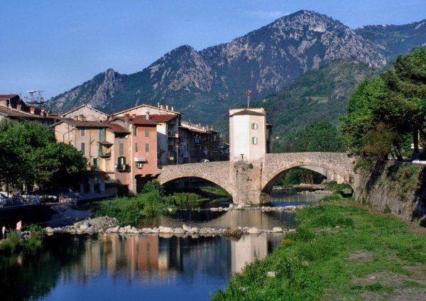
Access to the village ...
• From Nice or Italy by A8 highway, exit N°59 Menton then follow the road towards Sospel
passing through Monti and Castillon villages.
In the village take the left road at the traffic circle
(fourth exit) then the left one again in front of the Bevera river (avenue Jean Médecin).
• From Italy via the Col de Tende (Cuneo <-> Ventimiglia road), pass Saint-Dalmas-de-Tende and Fontan
and enter Breil-sur-Roya. Turn right on the road for Col de Brouis and follow to Sospel.
Cross the bridge and go straight ahead up to avenue Jean Médecin.
... and to free flying sites
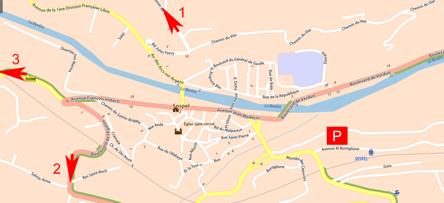
• Access to Mount Agaisen takeoff (15mn driving) and to Monte Grosso takeoff (45mn driving + 15mn walking) [--> 1] :
Continue straight on avenue Jean Médecin to West (Bévéra river on the right), then turn right to cross the bridge at the pharmacy level, then turn left. Leave the post office at the right and take the little road which goes up on the right (there is a wrong way roadsign on certain hours: don't be concerned, it's the right way!).
At the secondary school turn left and follow the road which goes up steeply for about 10 mn.
-> For the Mount Agaisen takeoff take the first road on the right and follow up to the car park.
-> for the Monte Grosso takeoff do not take the first road on the right, keep going for about 300m and turn right at the junction. Follow the tarred road then the forest track up to the large old military barracks in the right curve. Continue walking (15mn) the little track going Est immediately after the military barracks then follow along the path.
• Access to the Tête de la Lavina takeoff (45mn driving) [--> 2] :
Continue straight on avenue Jean Médecin to West (Bévéra river on the right), leave the pharmacy at right and go ahead on the rising road for about 400m then turn left and follow the road (D2204) to Col de Braus.
From Col de Braus turn left before the crumbling buildings and follow the forest track for about 500m up to a little pass the turn left to the track. The takeoff is about 300m further.
|
• Access to the Pigeonnier landing zone (Est of the village, 5mn walking) [ P ] : At the level of the traffic circle located at the arrival of the road from Menton take the road passing at the foot of the WW1 memorial (chemin de Suez). Leave the car on the place of the cooperative et follow chemin de Suez walking to the Est during 5 mn. In front of the house with blue shutters take the track on the left. Caution: it is essential to leave cars on the place of the cooperative and to not park in front of the blue-shuttered house ! |
|
updated : 03-07-2025

